Lazy Fall Hammock Camping in the Rain – Loyalsock Loop Link

3 Days of Hiking, Backpacking & Hammock Camping in the Rain on the Loyalsock Trail.

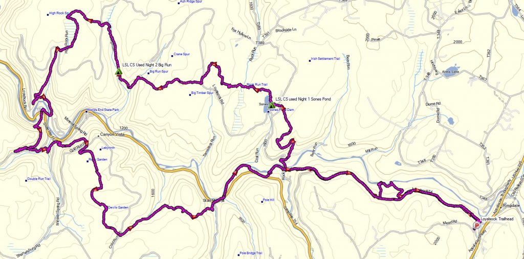
For this 3 day, 2 night fall backpacking trip, I’ll be hiking the 24 mile Loyalsock Link Loop, in Pennsylvania’s Loyalsock State Forest.  My goal for this rainy fall hike was a laid back, lower mileage trip with plenty of time at camp each day. For fun and comfort, I still used my minimalist sub 10 pound ultralight backpacking gear load-out. In addition to my usual gear list, I threw in a lightweight backpacking fry pan for some fun camp cooking to spice things up as well.


No permit is required to camp in the Loyalsock State Forest, so long as you are only camping one night at each campsite.  You can find more information on the Loyalsock State Forest website here.

Full GPS track data, including campsites, water sources, etc, for this trip and many others can be downloaded on my Trip Data Page.

Continue reading

How to use a GPS for Hiking (Dedicated Device or Phone App)

How to use a GPS Device or GPS App for Hiking & Backpacking Trips using Caltopo and free Garmin Basecamp GPS Software for route planning, point of interest waypoints, elevation profiles and more.

Whether you use a dedicated GPS device or a GPS phone app, the free tools and software I share in this tutorial can help you take your pre-trip planning to the next level.

Links to GPS Tools that I go over

  • Garmin Basecamp
    • This is the current version, but for the reasons discussed in the video, I would recommend that Garmin device users install the previous version 4.6.2 until they fix the map install issues on 4.7.0. If you’re using a GPS phone app, you’ll be fine with 4.7.0.
  • Basecamp Previous Version Archive
    • You can get version 4.6.2 here.
  • Forum thread with more info on the problems with Basecamp 4.7.0.
  • GPS File Depot
    • Great resource for free GPS maps.
  • Caltopo
    • Awesome web based GPS tool. You can use it as a standalone tool, but I prefer to use it as a supplement to Basecamp.  I pretty much just use it for the routable trails feature. Between the two, there’s not much you can’t do.
  • GPS Visualizer
    • Free tool for adding elevation data to GPS tracks. Simply export the track as a GPX file, run it through here, and re-import into Basecamp or directly into your GPS device.

Suggested maps to start with on GPS File Depot

  • Editor’s Choice map for the state you’ll be hiking or backpacking in.
  • My Trails
  • Trails 100

My GPS, seen on the video

Military Surplus Camping – B-47 Crash Site – Adirondack Mountains

Hiking & Backpacking with Military Surplus Camping Gear in the Adirondacks Eastern High Peaks Region

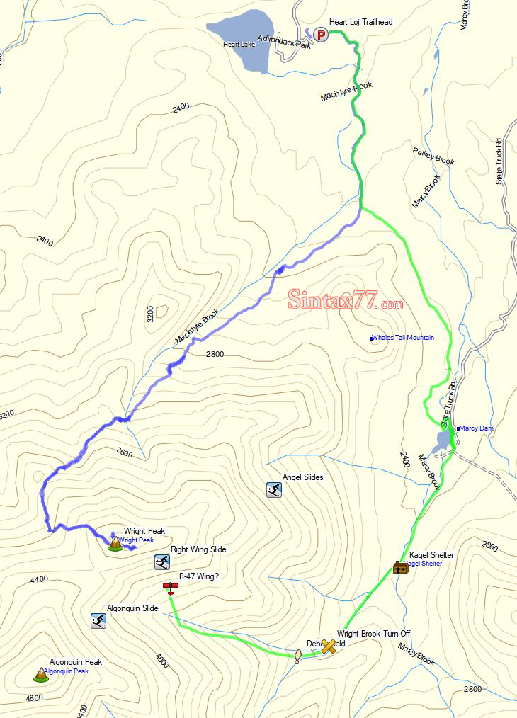
For this 2 day, 1 night adventure, I’ll be testing out and demonstrating my milsurp backpacking load-out, along with MRE (Meals Ready to Eat) food to keep me fueled up while I search for the remnants of a cold war era B-47 bomber that crashed on Wright Peak during the night of January 2nd, 1962.

My “big 3” for this backpacking trip are a medium sized ALICE pack, USGI Modular Sleeping bag with USGI Term-A-Rest sleeping Pad, and a USGI Poncho for shelter / rain gear. I scored each of these items for around $30.  A full gear list can be found at the end of this post.

No permit is required to camp in the Adirondacks, but there are rules and regulations regarding backcountry camping. You can find more information here.

Continue reading

Hiking the Ultimate White Mountains Backpacking Loop

3 Days of Hammock Camping, Hiking & Backpacking on the White Mountains Presicat Loop.

For this 3 day, 2 night summer backpacking trip, I’ll be hiking a 30 mile backpacking loop in New Hampshire’s White Mountain National Forest.  I call this the Presicat loop because it’s comprised of the Carter Range and Wildcat Range on one side, and the northern section of the Presidential Range on the other.

This route creates a grand tour of the northern White Mountains with a section of the Appalachian Trail and Mt Washington as it’s centerpiece.  Along the way we’ll hit 9 major summits (NH48’s) and 8 subsidiary peaks, while racking up 15,228 feet of elevation gain on some pretty rugged trails.

For sleep and shelter I chose a minimalist ultralight hammock camping system. This allowed me to get my base weight down to 9 lb.  Notable gear can be found in the gear section below. Or check out my full printable list with weights and links on LighterPack.

Presicat Loop Route Overview 2019 – Sintax77

No permit is required to camp in the White Mountains, but the trailhead I chose did require a self payment of $3 per day. Rules and regulations regarding backcountry camping can be found on the USFS website here.

Full GPS track data, including campsites, water sources, etc, for this trip and many others can be downloaded on my Trip Data Page.

Continue reading

Hammock Camping the Dolly Sods Wilderness – Solo Backpacking Trip

3 Days of Hammock Camping, Hiking, & Backpacking in the Dolly Sods  Wilderness.

For this 3 day, 2 night spring backpacking trip, I’ll be hiking a 23 mile loop in West Virginia’s Dolly Sods Wilderness, part of the larger Monongahela National Forest. Dolly Sods is located in the Allegheny Mountains on the highest plateau east of the Mississippi river and features some of the most varied and scenic terrain available to hikers in the Mid-Atlantic region.

For sleep and shelter system on my Dolly Sods backpacking loop, I packed in my Amok Draumr XL hammock, paired with the Amok Borg tarp and Amok Fjol XL sleeping pad.  I chose this combo based on plateau’s less aggressive terrain and the extra time I expected to be lounging and relaxing at camp.

No permit is required to camp in the Dolly Sods Wilderness, but there are rules and regulations regarding backcountry camping. You can find more information on the USFS Dolly Sods website here.

Full GPS track data, including campsites, water sources, etc, for this trip and many others can be downloaded on my Trip Data Page.

Continue reading

Hammock Camping on an Abandoned Mountain Farm – Quehanna Trail Ultralight Backpacking

Hammock Camping, Hiking & Ultralight Backpacking on the Quehanna Trail.

Yes, we’re once again camping in the rain. 🙂 For this overnight backpacking trip, I’ll be hiking a 22 mile loop in Pennsylvania’s Quehanna Wild Area, within the greater Moshannon State Forest.  Luckily, I learned from my last camping trip, and packed more adequate rain gear this time.

Itching for another hammock camping trip, I decided to have some fun and go back to more of an ultralight backpacking load-out for this adventure, clocking in at roughly 8.5 pounds base weight.

My full backpacking gear list, with weights & gear links is available on this lighterpacks.com link. A truncated notable backpacking gear list can be found at the bottom of this post.

Quehanna Short Loop – Route Overview – Sintax77

No permit is required to camp in the Quehanna Wild Area or the greater Moshannon SF.

Full GPS track data, including campsites, water sources, etc, for this trip and many others can be downloaded on my Trip Data Page.

Continue reading