FTC Disclosure: This post contains affiliate links, which means I may receive a commission for purchases made through some of my links.
For this backpacking trip, we hiked into the Cranberry Wilderness in search of a twin engine private plane that crashed in 1995 and went missing for 6 years, deep in the forests of a remote West Virginia mountaintop. There was also a hiker who went missing here back in 2011.
For sleep and shelter, Frank and I both decided to pack in our Amok Draumr Hammock camping systems. This would allow us to get a comfortable camping setup even if we were forced to camp in one of the mossy rock fields that are often encountered along mountain ridges in the Cranberry Wilderness. A detailed gear list can be found at the bottom of this post.
On the morning of November 28th, 1995, a Cessna 414, tail number N28901 took off from Braxton County Airport in Sutton, West Virginia headed for Lynchburg Regional, Virginia. After encountering low visibility due to foggy conditions, the lone pilot contacted air traffic control to request an IFR (instrument flight rules) flight plan in order to continue navigating the approaching mountainous terrain. After a period of apparent poor communications, possibly due to a radio issue, ATC lost contact with the pilot. Transponder signals ceased not long after the last communication, and the plane was never heard from or seen again until it was spotted from the air over six years later.
More info on N28901 can be found in this copy of the NTSB report.
No permit is required to backcountry camp in the Monongahela National Forest.
Full GPS track data, including campsites, etc, for this trip and many others can be downloaded on my Trip Data Page.
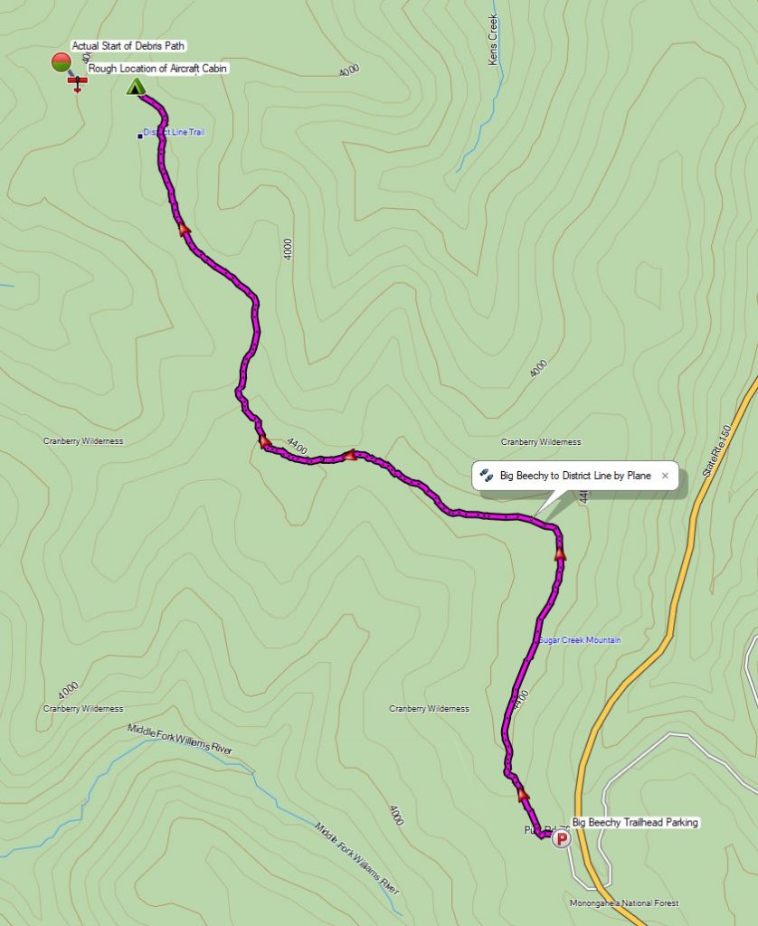
Trailhead Used: Big Beechy Trailhead, 38°17’44.2″N 80°14’55.7″W
Highland Scenic Hwy, Minnehaha Springs, WV 24954
This is a small parking lot with room for several cars that is easily accessible via a paved road, but it is not maintained in winter. No parking fee or permit is required.
Trails Used, Day 1
- Follow the dirt road for less than 1/8 mile
- Turn right (north) onto Big Beechy Trail (sign missing as of 2021)
- District Line Trail
- Setup camp along the District Line trail
- This is not an established campsite by any means, but it’s the best clearing we found along the District Line Trail and is also about as close as the trail comes to the crash site located about a quarter mile downslope. There is room for a couple hammocks or tents. There is no reliable water by the trail here, so make sure to pack it in with you. We did stumble upon a small creek further downhill while searching for the plane, but it’s not listed on maps and I can’t vouch for how often it’s actually running.
- Bushwhack downhill about 1/4 mile to find Cessna N28901
- We found that the debris field location differed slightly from the NTSB report. We found what appeared to be the initial impact sight at N38° 20.073′ W80° 16.845′ , and the fuselage at N38° 20.009′ W80° 16.783′ More details can be found in my GPS data for this trip.
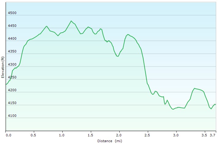
Day 1 Mileage: 3.7 miles
Day 1 Gross Elevation Gain: 562 feet
Day 1 Gross Descent: 639 feet
Trails Used, Day 2
- Retrace yesterday’s route.
- Return to Big Beechy Trailhead.
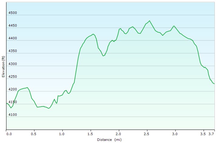
Day 2 Mileage: 3.7 miles
Day 2 Gross Elevation Gain: 639 feet
Day 2 Gross Descent: 562 feet
Grand Total Mileage: 7.4 Miles
Grand Total Gross Elevation Gain: 1,201 feet
Notable Backpacking Gear
- Frank’s Budget Backpack
- Sintax77’s Fjallraven Kajka 75 Backpack
- Amok Draumr XL Hammock
- Amok Borg Tarp
- Amok Fjol XL Winterlight Sleeping Pad
- Outdoor Vitals Storm Loft 15° Mummy Pod (Frank)
- Hammock Gear Burrow 20 Top Quilt (Sintax77)
- GSI Outdoors Halulite Tea Kettle
- BSR Ultralight Canister Stove
- MSR Flex Skillet
- Light My Fire Mini Fire Steel Striker
- Light My Fire Tritan Spork
- Marmot Eclipse Hardshell Jacket
- Military Fleece Jacket
- Outdoor Vitals Satu Adventure Pants
- Hardshell Pants – Military ECWCS Gen III Trousers
- Solomon Toundro Pro CSWP Boot
- Byer of Maine Trilite Camp Stool
- Nitecore NU25 Headlamp
- Casio ProTrek F30 Smartwatch
- Benchmade Bugout EDC Folding Knife
- Surplus MRE’s (Meal Ready to Eat)
- Mountain House Sausage Biscuits & Gravy
Camera and Nav Gear used for this episode
- GoPro Hero 8 Black
- GoPro Shorty Tripod Grip
- 128GB Sandisk Extreme Memory Card
- Spot Gen3 GPS Messenger & SOS device
- Garmin Oregon 650
Music heard in this episode (Licensed via Artlist)
Cities Under Guns by Francesco D’Andrea


